Mount Goldie and Goldie Lake
Mount Goldie is a non-technical, long slog of a hike. It is a Class 2 hike with one or two places where I might have used my hands - all you really need for this one is some endurance. I chose this hike because I was looking for a non-exposed hike to do with a friend that would take most of the day. The panoramic views are really good, but I have gotten better views from shorter hikes - my knees were feeling a little battered by the end, and I was incredibly happy that I brought trekking poles to save them from further pain.
Date: Aug 8, 2020
Park: N/A
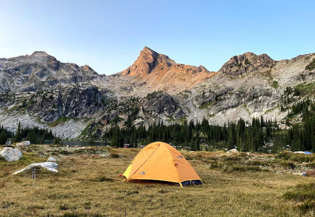
Name of Hike: Mount Goldie, Goldie Lake
Mountain Range: Purcell Mountains
Elevation: 2647m
Distance: 21.0km (according to Topo Maps+ app)
Elevation Gain: 1651m (according to Topo Maps+ app)
Total time (including breaks): 7.25 hours
Before this hike, I googled pretty hard to find some information but I was only able to spot one blog post by a fellow named Bob Spirko. It definitely isn't a popular hike, as the only other hikers we saw were a rather friendly couple that were coming up as we were halfway down the mountain.

Above: Mount Goldie viewed from the trail.
Below: Goldie Lake and many mountains in the Purcell range.

We parked in the Panorama Mountain Resort parking lot, and after leaving we got a little confused as to which path we should follow. Luckily, a resort employee who happened to be driving his truck down gave us a map and very clear directions. You can find a copy on the resort website if you try to look up the mountain biking trail map. Here it is (I apologize - the image quality is definitely subpar):

Our route was as follows: we started off by following the Mile 1 Express chairlift up via a maintenance road. At the Mile 1 Hut, we took the Summit Trail up to Summit Hut, worked up to Outback Ridge, took a left at the first McKay dot on the map and then hiked up the mountain. We ended up coming down on the other side of the ridge and we visited Goldie Lake briefly before heading back down. Here is a look at our approach at the top of the mountain. Unfortunately, most of this hike involves walking up a maintenance road. It doesn't feel quite as nice as a nice narrow path through the woods but such is life.


We started hiking around 9:40am. The first stretch to the Mile 1 Hut is the steepest section by far. If I could go back, I would be very tempted to take a chairlift up to save my legs a little. The picture below was taken at 9:50am.

The views looking back aren't too bad. The pictures below were taken at around 10:45am and 11:10am, respectively.


There was a very light sprinkle and I saw one of the strongest (as in well defined) rainbows I've seen in years (all three pictures below taken around 11:30am). The right side of the rainbow is particularly vibrant in the second picture below. There was a little outhouse bathroom here and we hit a bit of a steep section again (my friend is going up this section in the third picture).


Below: more views along the trail, and Mount Goldie finally visible (both taken around noon).


In the picture below we are approaching the actual mountain, just a little after 12:30pm. The true summit of Mount Goldie is the rightmost peak in the third image below. It was really nice to finally get off the maintenance road and onto a proper trail.


The path up the mountain is fairly switchback-y but there is very little exposure and the rocks are not too loose. There isn't really any scrambling, and it isn't that steep as mountains go. The hard part for us at this point was the wind - it really picked up quite a bit, and I genuinely can't remember a time in the last few years when I've felt stronger winds. I was incredibly naive and did not bring a windbreaker, and I think I learned a very valuable lesson. We were pretty sure eating our lunch at the summit would not be possible so we stopped at around 1pm at a little spot on the way up with a few boulders where we were fairly protected from the wind (see second picture below). Fortunately, there are a few spots on the summit with large boulders that would have provided protection had we chosen to eat there.


I took a video here instead of a panorama:
A few loose rocks here and there but still pretty easy - this is about as scramble-y as this hike gets:

We were on the top of the ridge within ten minutes of finishing up our lunch. The fissures were quite interesting to look at. They don't seem to be more than a couple metres in depth but they sure are an interesting geological phenomenon - I actually haven't seen these on a mountain top before.

After an easy navigation through the fissures we followed the path to the next peak on the ridge.

I felt like the best views were at the peak just before the true peak. The combination of the mountains in the distance and Goldie Lake in the foreground results in a really beautiful picture.

All three pictures below were taken a little after 1:30pm. Great panoramic views up top!


We finally reached the true summit (pictured above) around 1:50pm, roughly 4 hours from when we started. I cross referenced with Google Earth and PeakVisor to determine the names of some of the more visible peaks and marked them on the second picture.


Now: downwards! We tried to find a route down the ridge that would go to Goldie Lake in order to save time but we couldn't find any well-trodden trail down the ridge. In the first picture below you can see my friend trying to look for a trail. We cut across to the left (see second picture below) and eventually found a trail that took us down to the lake. Fortunately, the lack of tree cover makes it really easy to figure out how to get to the lake - it's pretty hard to get lost. There were some loose rocks but it was fairly easy coming down.


We found the trail to the lake at last:

We got to the lake at around 2:40pm. Goldie Lake is a nice little body of water, but the color definitely comes out better when looking down from above. The water was a very reasonable temperature for the elevation - if it was a warm day and I had brought trunks I might have even hopped in.

We headed back down from the lake and saw a few mountain bikers on this path. Overall the resort seems to be much more popular with mountain bikers than hikers - we saw tons of bikers and only two hikers the entire day.


Pictured below is the last little downhill stretch. I know it doesn't look that long or steep but this section hurt my knees the most. We saw a few deer but the one in the second picture was the only one I could get close enough to get a decent picture. We finally finished at around 5:15pm (~7.25hrs from our start time, ~3.5 hours to come down).


As I mentioned before, I did enjoy the views on this hike, but I thought the amount of time spent on the maintenance road was a little high - it doesn't feel like a real hike if I know a truck can easily make it up most of the way. Nonetheless, I am happy I have finally summitted a mountain in the Purcell range.
I do hope I can come back and do more of the scramble-able mountains in this area one day. Mount Nelson caught my eye and it is a Class 3 scramble but I remember reading that the elevation gain is 2km over a ~5km trail and that it is quite a challenging hike. Hopefully I can get to it one day!


Comments
Post a Comment